Map features/Units
Some tags have measurable values. The unit of such a value can be given explicitly as part of the value (e.g. maxspeed = 50 mph ). If no unit is specified, a default unit will be assumed (e.g. for maxspeed = 50 , the unit kilometre per hour is assumed). If the unit is different from the default, e.g. in non-metric countries, stating a unit is obligatory.
This article shows which units can be explicitly specified and which default units are implicitly assumed.
Default units
If no unit is explicitly specified, the following units are assumed:
| Measure | Default unit | Implicit specification | Example |
|---|---|---|---|
| Distance over land | kilometre (kilometer) | km | distance = 5 means a distance of 5 kilometres |
| Distance over water (ocean) | nautical mile | nmi | seamark:light:range = 3 means a distance of 3 nautical miles |
| Siren range | metre (meter) | m | siren:range = 600 means a siren audible over a 600-metre-radius area |
| Flow rate | cubic metre per second | m³/s | flow_rate = 600 means a flow rate of 600 m³/s |
| Frequency | hertz | Hz | frequency = 50 means a 50 Hz wire |
| Height | metre (meter) | m | ele = 20 means an elevation of 20 metres; height = 10 means an height of 10 metres |
| Length | metre (meter) | m | length = 10 means a length of 10 mètres and width = 3 means a width of 3 metres |
| Length (small-scale) | millimetre | mm | gauge = 1435 means a standard gauge of 1435 millimetres |
| Pressure | bar | bar | pressure = 86.2 means a pressure of 86.2 bars |
| Speed | kilometres per hour | km/h | maxspeed = 100 means a speed limit of 100 kilometres per hour |
| Weight | tonne (metric ton) | t | maxweight = 3.5 means a weight limit of 3.5 tonnes (3500 kg) |
| Voltage | volt | V | voltage = 15000 means a 15 kV wire |
| Volumes | cubic metre | m³ | volume = 15 means a 15 m³ volume |
Explicit specifications
The following units can be explicitly specified by adding them after the numeric value, separated by a space (with the exception of the combined specification of feet and inches):
Unusual keys
The following keys do not accept the standard syntax for units described above:
- depth =* – metres only, no provision for feet and inches
- ele =* – metres only, no provision for feet and inches except as a colon-delimited subkey; see the proposal to eliminate this exception
- railway:position =* – requires miles to be prefixed by mi:
- seamark:distance_mark:distance =* – uses seamark:distance_mark:units =* to specify the unit
Common mistakes
The following table presents examples of incorrect or discouraged tag usage together with their correct notation.
| Incorrect usage | Explanation | Correct usage |
|---|---|---|
| height= 6m | Missing space between numeric value and unit. | height = 6 m |
| maxweight=3 , 5 | Comma used as decimal separator. | maxweight = 3.5 |
| width=12′ 6″ | There should be no space between the specification of feet and inches. | width = 12'6" |
| maxspeed=50 kph | Usage of an alias. | maxspeed = 50 km/h |
Notes
The precision of a measurement entered into OSM should match the precision of the source. For example, a «max width = 3.01m» sign should be recorded as maxwidth = 3.01 (not maxwidth = 3 ) and a «max height = 12 ft» sign should be recorded as maxheight = 12' (not maxheight = 12'0" ). Data consumers should take care when converting between non-default and default units (e.g., mph to km/h) to maintain sensible precision.
References
- ↑ The symbol «cwt» is ambiguous: in the United States, it refers instead to the short hundredweight of 100 pounds (45 kg). However, this unit is only tagged in OSM according to standard signs in Guernsey and outdated signs in the United Kingdom, whereas hundredweight measurements have seldom if ever been signposted in the United States.
See also
- Category:Units for a list of related tags and pages
- Units of measurement on Wikipedia
- Sophox query for the world’s total electrical output – demonstrating how to convert units on the fly when querying OSM
Источник
Key:ele
Elevation (height above sea level) of a point, in metres. This is mainly intended for mountain peaks but could also be used for elevation of airport runways and many other objects.
For OpenStreetMap, this value should be in metres above above mean sea level as defined by the EGM96 geoid model. This elevation is usually very close to national «above sea level» systems with differences < 1m. This is not the height above the WGS84 ellipsoid (see wikipedia:Geoid for details on how these differ) which is shown as raw elevation by some satellite navigation devices and which can differ from geoid elevation by up to 100 m.
In case of buildings and other man_made =* structures that stand on the ground, tag the elevation of the surrounding ground, not of the structure itself (i.e. don’t tag the elevation of a building’s roof top, or the tip of a tower; instead, set ele =* to the elevation of the ground level, and add the height with the tag height =*).
Basics
OSM currently records points with their latitude and longitude (x/y coordinates), elevations are only recorded for features where they are significant like for peaks or surveyed points. Where this is done, the elevation above geoid (EGM96) is stored in the ele =* key. OpenStreetMap does not try to be a general elevation database so you should not tag elevation of nodes with no other tags and no specific meaning that suggests an elevation value is significant information in this case.
A proposal for vertical datums other than the EGM96 geoid is to store them in keys such as ele:xyz =*, where xyz is the map datum and elevation is specified in metres.
The elevation in a local datum can be tagged as ele:local =*, with elevation specified in metres.
Sources for elevation values can be signs or values from literature. Such values should however also be checked for plausibility since elevation signs and official mountain heights are known to be frequently inaccurate. Another source of elevation data is GPS traces but elevation values from these are usually much less accurate than the horizontal position. You also need to make sure values are in the correct coordinate system or converted as necessary in case of ellipsoid based elevations.
Another source of elevation data are gridded elevation data sets. Such are often used in outdoor maps to render relief, like OpenCycleMap and Reit- und Wanderkarte and elevation values can be determined from displaying these maps as a background layer in editors. Beware however that such data sets contain a significant amount of noise and errors and absolute elevation values can easily be off by 50 metres.
In general elevation information with sub-metre accuracy is rarely verifiable so elevations should usually be specified in integer metres.
National reference systems
Elevations posted on official signs are usually relative to the national reference system of the respective country and have to be converted to WGS84/EGM96.
| Country | Standard | Common name | Heights | Tide gauge | Reference point | Conversion |
|---|---|---|---|---|---|---|
| Australia | Australian Height Datum | Metres above mean sea level | 32 distinct tidal references points on Australian coastline. | Ausgeoid09. | Conversion calculator online | |
| Austria | Meter über Adria (m ü. Adria) (metres above Adriatic) | Normal-orthometric | Trieste 1875 | Hutbiegl | ||
| Belgium | meter boven Oostende Peil (m O.P.) (metres above Oostende tide gauge) | Orthometric | Ostende | Ostende | ||
| Czech Republic | Bpv (Baltic Sea vertical datum) | metrů nad mořem (m n.m.) (metres above sea level) | Normal (Molodenskii’s) | Kronstadt | Kronstadt, Russia | |
| Estonia | BK77 | Normal | Kronstadt | Kronstadt | [2] | |
| Finland | N43,N60,N2000 | Orthometric | Helsinki | Helsinki | [3] | |
| France (mainland) | NGF-IGN69 | mètres au-dessus du niveau de la mer (m) (metres above sea level) | Normal | Marseille | Marseille | [4] |
| France (Corsica) | NGF-IGN78 | mètres au-dessus du niveau de la mer (m) (metres above sea level) | Normal | Ajaccio | Ajaccio | [5] |
| Germany *) [1] | DHHN2016 | Meter über Normalhöhennull [6] | Normal | Amsterdam | Wallenhorst | |
| Former West Germany *) | DHHN12 | Meter über Normalnull | Normal-orthometric | Amsterdam | Hoppegarten (near Müncheberg) | |
| Former East Germany *) | SNN76 | Meter über Höhennull (m ü. HN) | Normal | Kronštadt | Hoppegarten (near Müncheberg) | |
| Hungary | Tengerszint feletti magasság | Normal | Kronštadt | Nadap | ||
| Ireland | metres above sea level (m ASL / m a.s.l.) | Orthometric | Malin Head | Malin Head | ||
| Italy | metri sul livello del mare (m s.l.m.) (metres above sea level) | Orthometric | Genoa | Genoa | ||
| Japan **) | Tōkyō-wan heikin kaimen (東京湾平均海面) (Tokyo Peil, T.P.) | Orthometric | Chiyoda, Tokyo | Nihon suijin genten (日本水準原点), 24.3900m **) | ||
| Liechtenstein | LN02 | Meter über Meer (m ü. M.) (metres above sea level) | Marseille | Geneva | ||
| Luxemburg | Orthometric | Amsterdam | Amsterdam | |||
| Netherlands | meter boven/onder NAP (m NAP) (metres above/under NAP) | Orthometric | Amsterdam | Amsterdam | ||
| Norway | meter over havet (moh.) (meters above sea level) | Normal-orthometric | Tregde | Tregde | ||
| Poland | metry nad poziomem morza (m n.p.m.) | Normal | Kronštadt | |||
| Portugal | Nível médio do mar adotado (NMA) | Orthometric | Cascais | Datum Altimétrico Nacional de 1938 (Cascais) | ||
| Russia | BS1977 | vysota (metry) nad urovnem morja (высота (метры) над уровнем моря) (elevation/metres above sea level) | Normal | Kronstadt | Kronstadt | The pseudo-geoid model EGM2008BALT is available for St. Petersburg / Kronstadt area [7] |
| Slovakia | metrov nad morom (m n.m.) (metres above sea level) | Normal | Kronštadt | |||
| Slovenia | Normal-orthometric | Trieste 1900 | Ruse | |||
| Spain | metros sobre el nivel del mar (msnm) (metres above sea level) | Orthometric | Alicante | Alicante | ||
| Sweden | RH2000 | Meter över havet (m ö.h.) (metres above sea level) | Normal | Amsterdam | ||
| Switzerland ***) [2] | LN02 | Meter über Meer (m ü. M.) (meters above sea level) | Marseille | Geneva | ||
| Turkey | Normal-orthometric | Antalya | Antalya | |||
| UK — Great Britain | Ordnance Datum Newlyn | metres above sea level (m ASL / m a.s.l.) | Orthometric | Newlyn, 1915 to 1921 | Newlyn | OSGM02, Coordinate transformer |
| UK — Northern Ireland | Belfast Ordnance Datum | metres above sea level (m ASL / m a.s.l.) | Orthometric | Clarendon Lock, Belfast, 1951 to 1956. | Clarendon Lock, Belfast | |
| Former Yugoslavia | Nadmorska visina (m/nv, ~metres above Adriatic) | Normal-orthometric | Trieste 1875/1900 |
*) DHHN92 was adopted gradually after reunification. Even newer topograpic maps may still use the former reference systems.
Former East Germany used DHHN-12 on the territory of East Berlin, in rail contexts and for landlocked waterbodies.
**) National authorities use this datum only for the four main islands of Hokkaidō, Honshū, Shikoku, Kyūshū and associated islands. For Sado, Oki, Tsushima, as well as for the Izu, Ogasawara and Ryūkyū islands, the mean sea level of a nearby coast or bay is used. For example, the reference point for Miyake-jima, which belongs to the Izu islands, is the mean sea level of Ako Bay on the western coast of the island.
***) LN02 remains in force. For LHN95, which uses orthometric elevations, the reference altitude of Repère Pierre du Niton was kept. [3]
Example
The height of Breithorn in Switzerland is 4 164 metres. It could be mapped as:
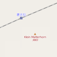
The height of rail tracks in Tanggula railway station is 5 068 metres. It could be mapped as:
Local units
It’s been noted that some elevations are more conspicuous than others, and the requirement that key:ele be in metres is unhelpful for denotation on mountain peaks in non-metric areas. Since locals in the United States (and certainly elsewhere) think of things like mountain elevations strictly in feet, there seems to be no good way to address this with the current framework.
- It’s tempting to enter an elevation with a unit of measure («3045 feet») but the tag must be in metres
- Some software relies on this tag being numeric metres
There is likely no good solutions to this without using a separate tag for tagging height in local units. As of September 2021, ele:ft =* is used on over 2,300 features, while about 600 features are tagged with feet or inches in ele =*.
Features with variable elevation
Most terrain features have a constant elevation, meaning the ele tag is unambiguous. There are some exceptions, however, that can offer challenges when mapping elevation.
One example of this is a reservoir. When using the ele tag on a non-intermittent, ordinary lake, if usually refers to the elevation of the (close to constant) water level. Since reservoirs have water levels that change within certain bounds, it is unclear how one should interpret the ele tag when present on a reservoir, as it could be referring to the maximum water level, the minimum water level, or something in between. There is not yet an agreed upon scheme for making the meaning more clear, but some mappers use the following tags to add clarity to the situation:
- ele:min to denote the minimum water level achievable by regulation. Usually corresponds to the lowest point in the transition between a reservoir and a drainage tunnel/pipe.
- ele:max to denote the maximum water level achievable by regulation. Can correspond to the level of the spillway, or higher. Might need further refinement.
- ele:natural to denote the water level the reservoir had before it became a reservoir.
Источник